
*While I don’t typically write trip reports about completely failed summit attempts, getting beta on US sites on peakbagging in the Alps can be somewhat difficult, so I thought adding this into the mix might be worthwhile.
After my failed attempt on Vorder-Grauspitz, I was turning my attention to 4000 meter summits the rest of the trip, culminating in a summit attempt of Mont Blanc, the highest summit in the Alps and all of Western Europe. The first 4000 meter summit I had planned was Allalinhorn, which thanks to the Metro Alpin, is one of the “easiest” 4000 meter peaks in the Alps. As I would find throughout the trip, easy is relative, and depends significantly on conditions. I drove to Saas Fee on Saturday evening under cloudy skies and a light rain, and went into a local gear shop to ask about conditions. The shopowner’s answer was not promising- “Wet. It’s been raining all week.” In fact it had been one of the wettest springs for the Alps in recent memory, and aside from my first day in the mountains, it rained every single day I was there.
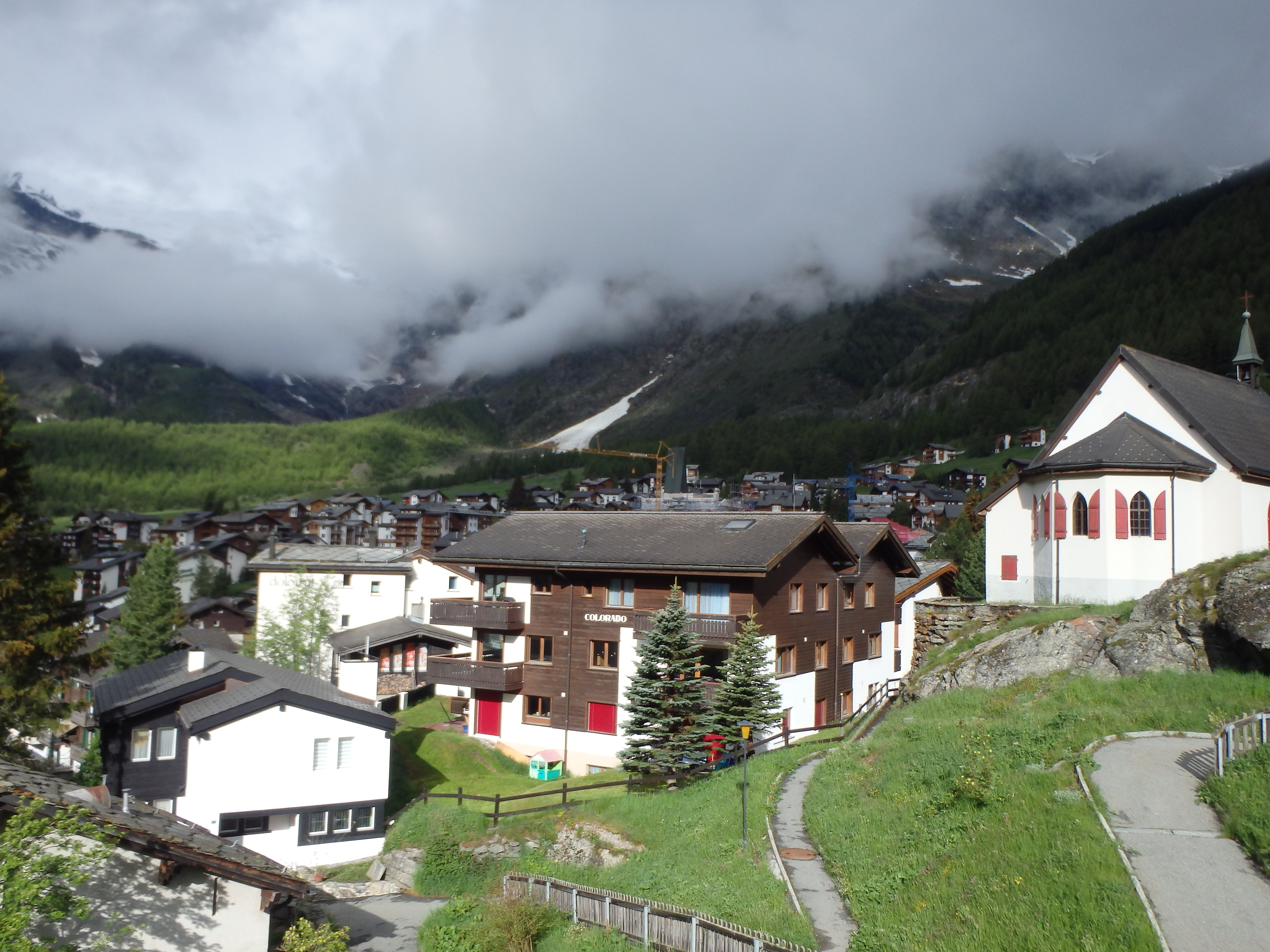
Regardless, I had traveled across the world for some genuine alpine climbing, so that’s exactly what I was going to do. I woke up early at my small bed and breakfast in Saas Grund and drove to the large Saas Fee car park. The first cable car up wasn’t until 8:30, and when I arrived at the station, I found it closed up tight. I waited in front for 20 minutes, waiting for someone to unlock the doors. Eventually, a man pulled up in a truck asking what I was doing. I told him I was trying to get up to Metro Alpin. He pointed into his truck and said “come with me, this lift is still closed, the other lift up the valley is open.” I jumped in and was driven to the other lift. After paying for my lift ticket (partially covered if you stay in the Saas Fee valley, including Saas Grund), I got into the large lift to ascend to the first station at Felskinn.
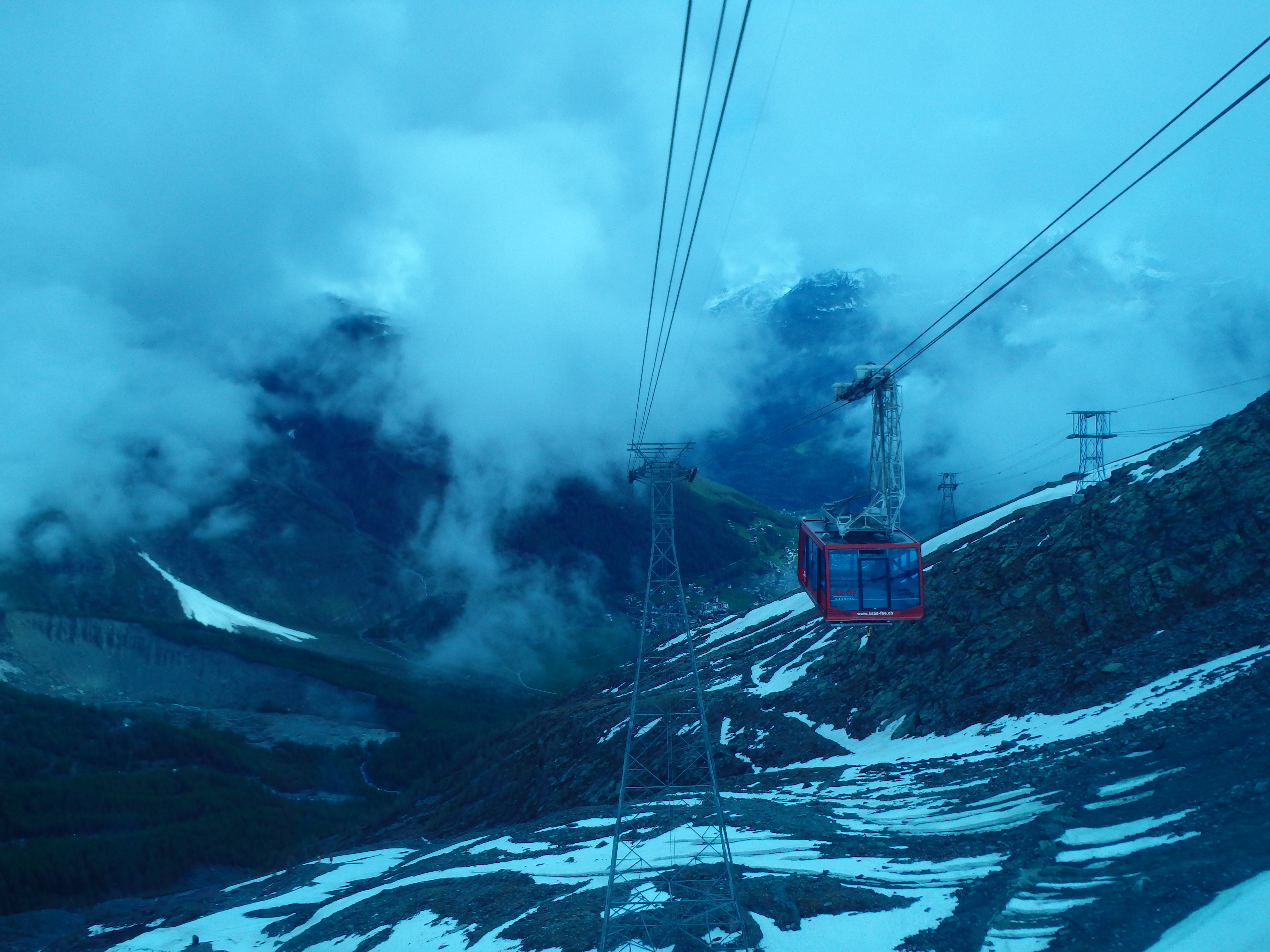
The only other person on the lift was a chubby guy from Russia, who asked if I was going to the restaurant at the top. You know, because most people go out to eat with their ice axe. Once at Felskinn, you must take the Metro Alpin to get to the higher station, an incredible subway that steeply climbs under the glacier. The trip to the other station took another 5 minutes, and I left the dimly lit subway and stepped onto the glacier…. completely lost in clouds.

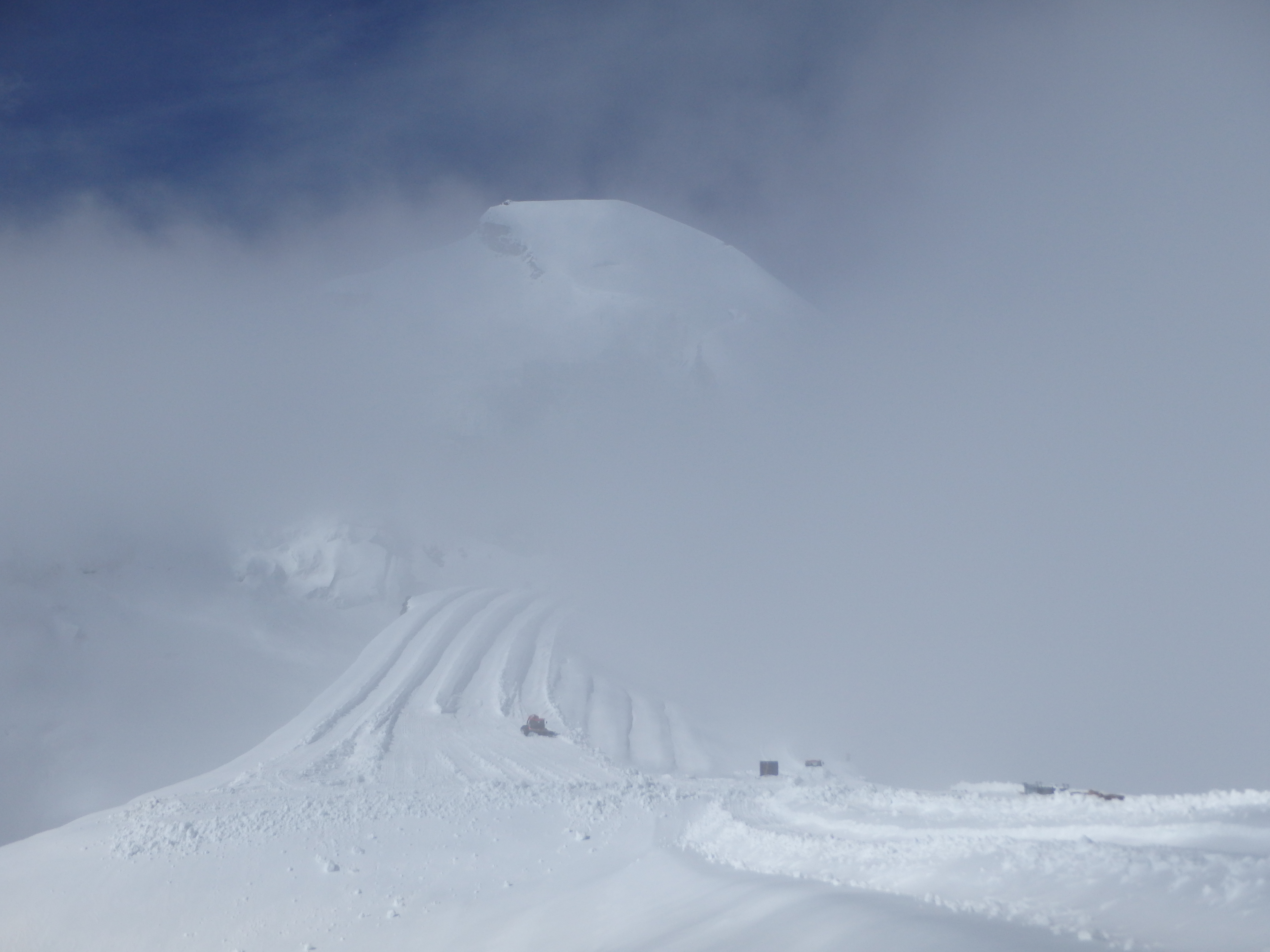
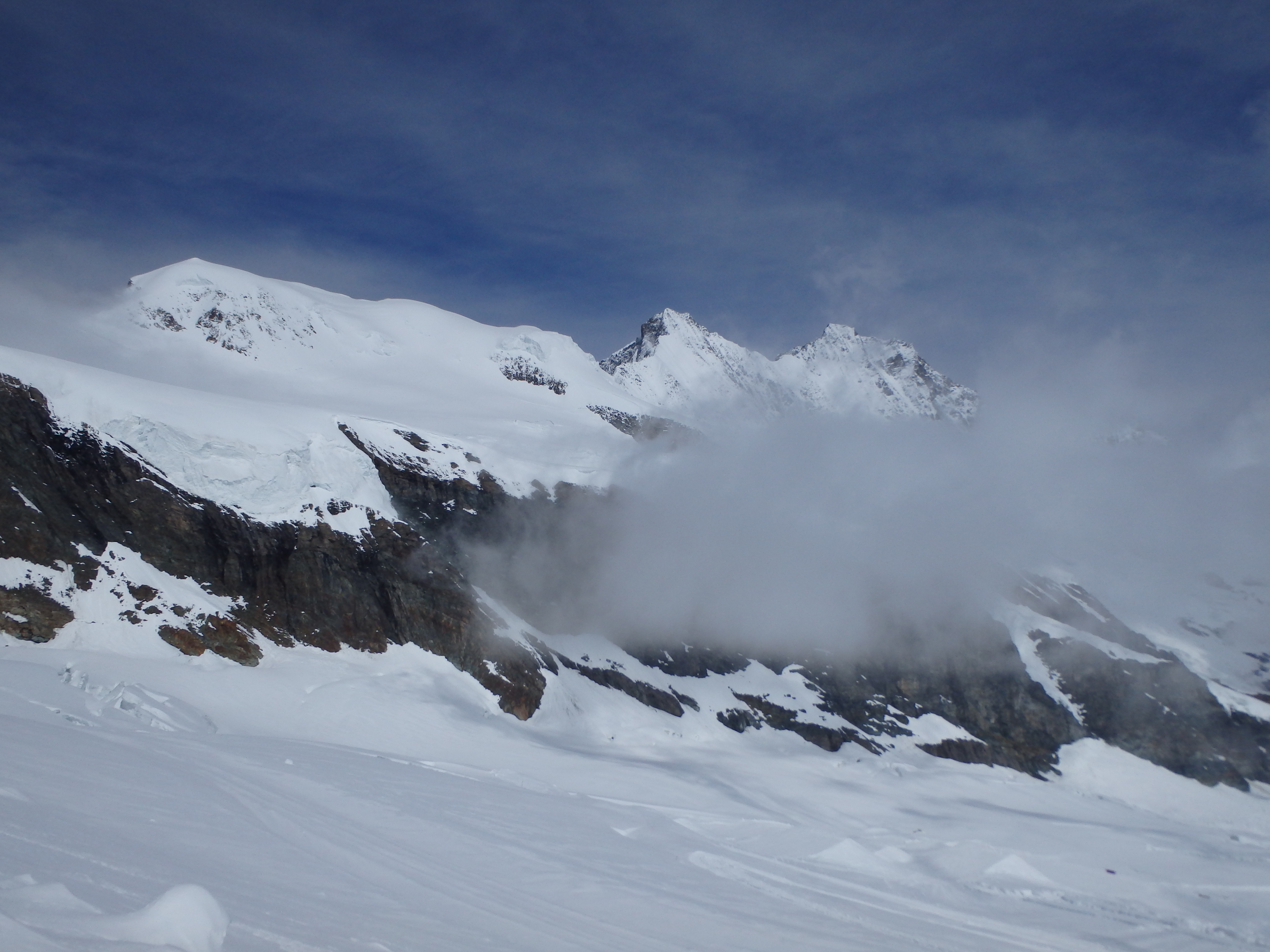
Allalinhorn, normally visible directly above Metro Alpin Station, was out of sight from the thick clouds. I slowly put on my crampons, and figured I would head along the groomed ski tracks in the general direction of the saddle, with hopes that the clouds would lift as I grew closer. I barely made it 100′ before a man jumped out of a ski grooming machine and asked what the hell I was doing. I pointed up in the general direction of Allalinhorn and he shook his head. “Too dangerous, the crevasses are still hidden. No one has climbed it yet this year.” I told him that I would stick to the ski areas for now, and reassess the conditions closer. He nodded his head in agreement, saying the ski area would be safe, but not to stray further. I pressed on the relatively tame uphill, with fresh snow making progress in even the groomed areas slow. As I climbed higher to about 3500 meters, the clouds began to dissipate, and I had my first good look at the summit of Feechopf, as well as Feejoch, the saddle I was aiming for.
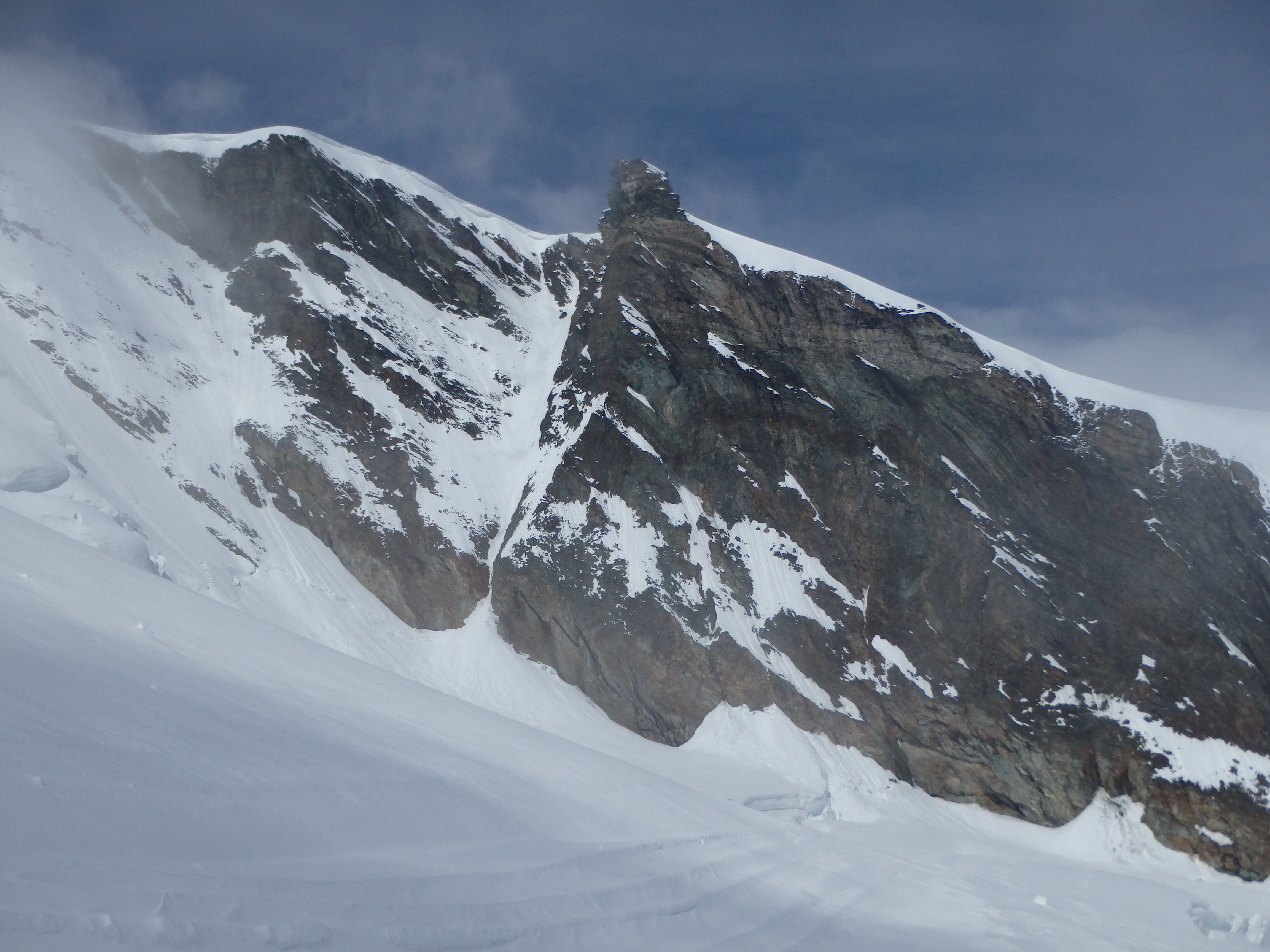
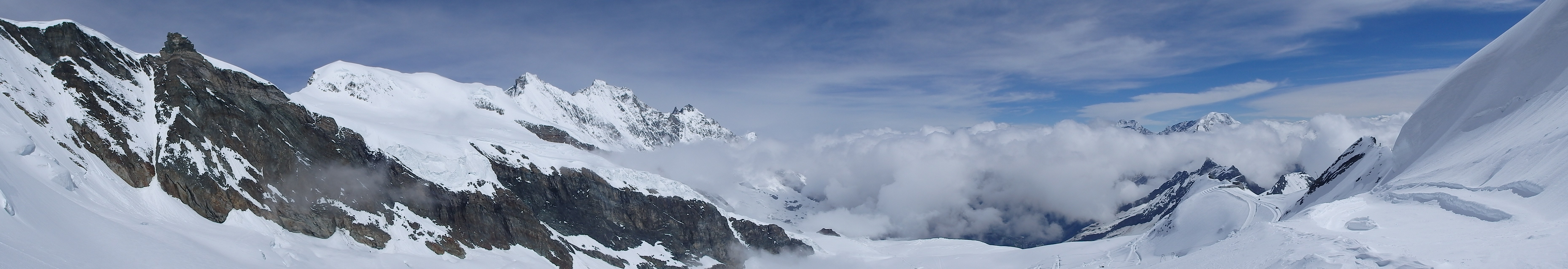
The lower slopes did not look promising. I could see huge crevasses cutting across the slope below the saddle, half covered by fresh snow. My only hope would be to find a track at the top of the ski runs. I continued onward, the clouds continuing to clear, offering incredible views of the entire valley including Alphubel, Dom, Lagginhorn and Weissmeis across the valley.

I hit about 3800 meters, only 200ish meters below the summit and 50 meters below the saddle (Feejoch), when the ski track stopped. With the improved visibility I could see numerous crevasses between myself and the saddle, half buried in snow and not really well defined. I could envision a track heading up through them, but with the fresh snow, smaller ones could easily be hidden, and the ends might extend beyond what I could see.

Alps- 2, Chris- 0. I turned around and slowly made my way back towards Metro Alpin. I briefly considered the Northeast ridgeline, and I could see the summit cross high above. But this route, although looking clear, was rated AD with a serious bergshrund to cross half way up, and most parties bringing ice screws for the ascent.

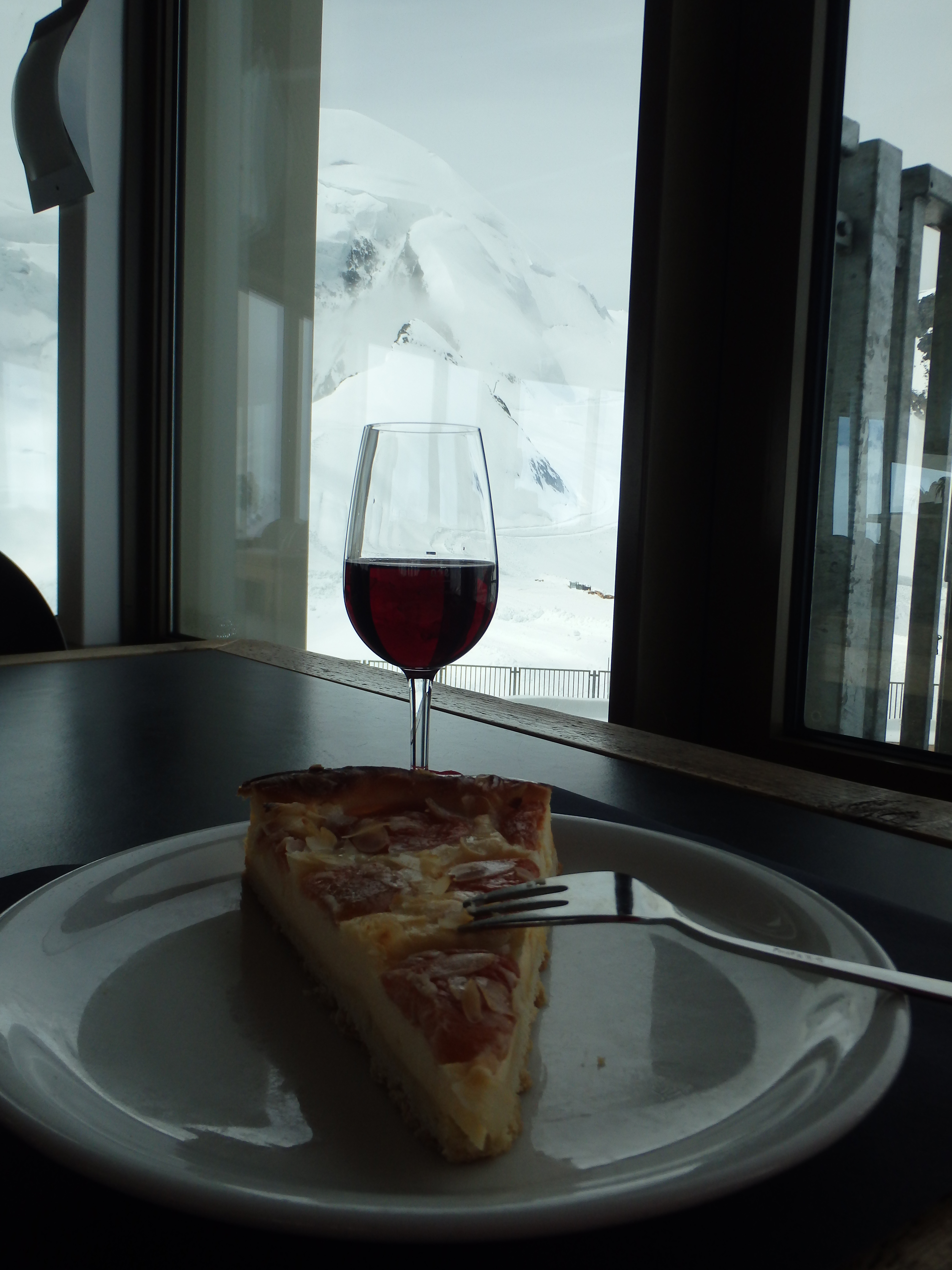
Defeated, I cut my losses and went up into the Metro Alpin Station to drown my sorrow in some local wine and apricot cheesecake before leaving Saas Fee for Zermatt.
Great post! Good to know about part of the lift being included in the Citizens Pass (from accommodation or tourist office). The Saas Fee guides office is helpful for up to date conditions. It is in the centre of town before you get to the church.
Thanks for reading! Hope to get back there someday and make another attempt when the conditions are a bit better!