
Total Time: 10 hours


I hadn’t had a hike in a while that really kicked my ass- a sunup to sundown day with mileage in the high teens. Further, I felt I had been neglecting the Superstitions, having not visited them since October. Thus, on New Year’s weekend, when Holly gave me the green light for a full day of hiking, I thought a 4 summit loop in the eastern Superstitions would fit the bill nicely. The highlight of the loop and primary objective was Battleship Mountain, a fin of tan volcanic rock with sustained scrambling, reminiscent of Angel’s Landing in Zion NP, minus the cables. Along the loop I had planned, there were three other summits within striking distance of the trail, and would all make for short detours along the way. I left home at 6AM and arrived at the First Water trailhead at first light.
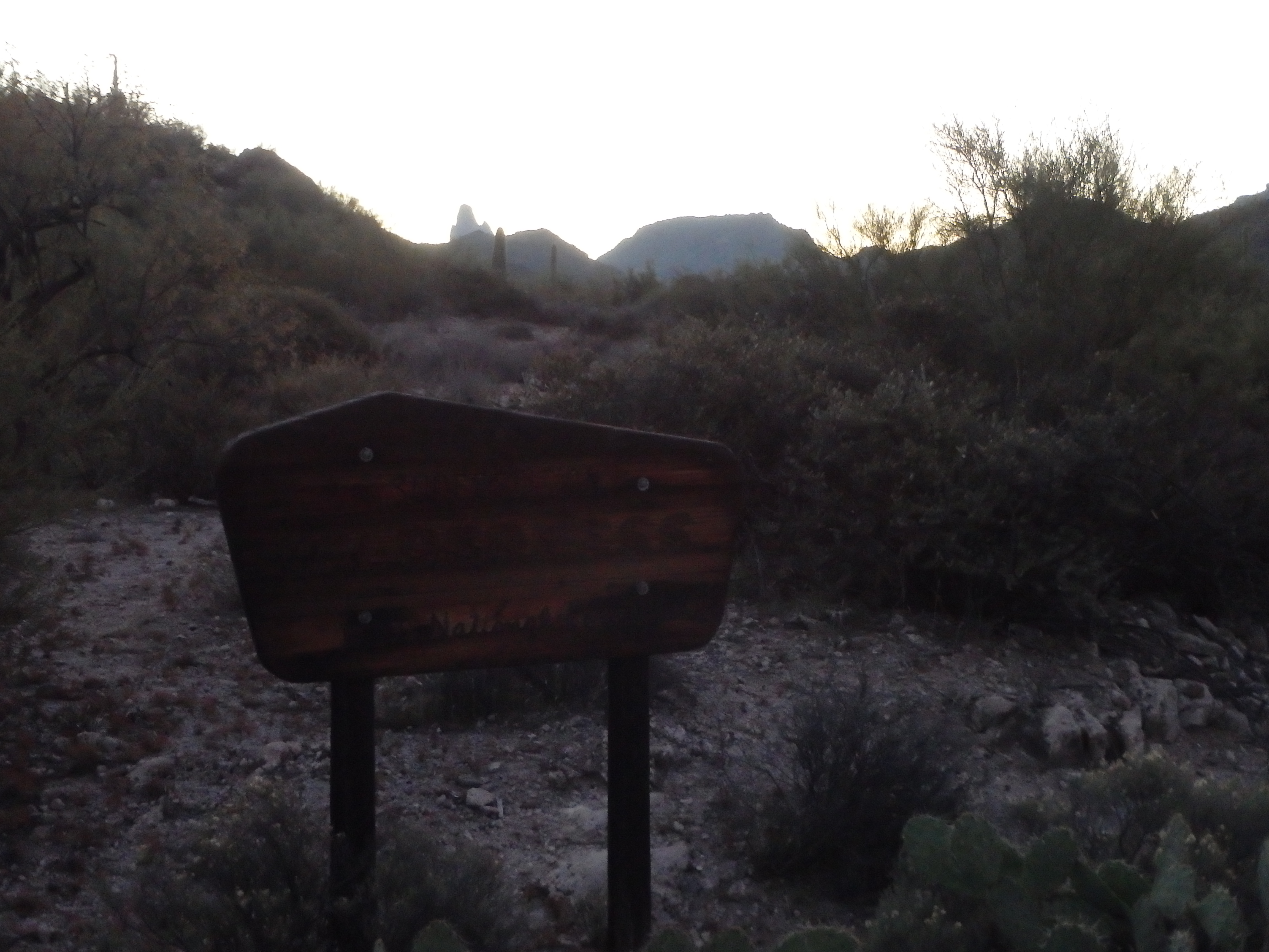
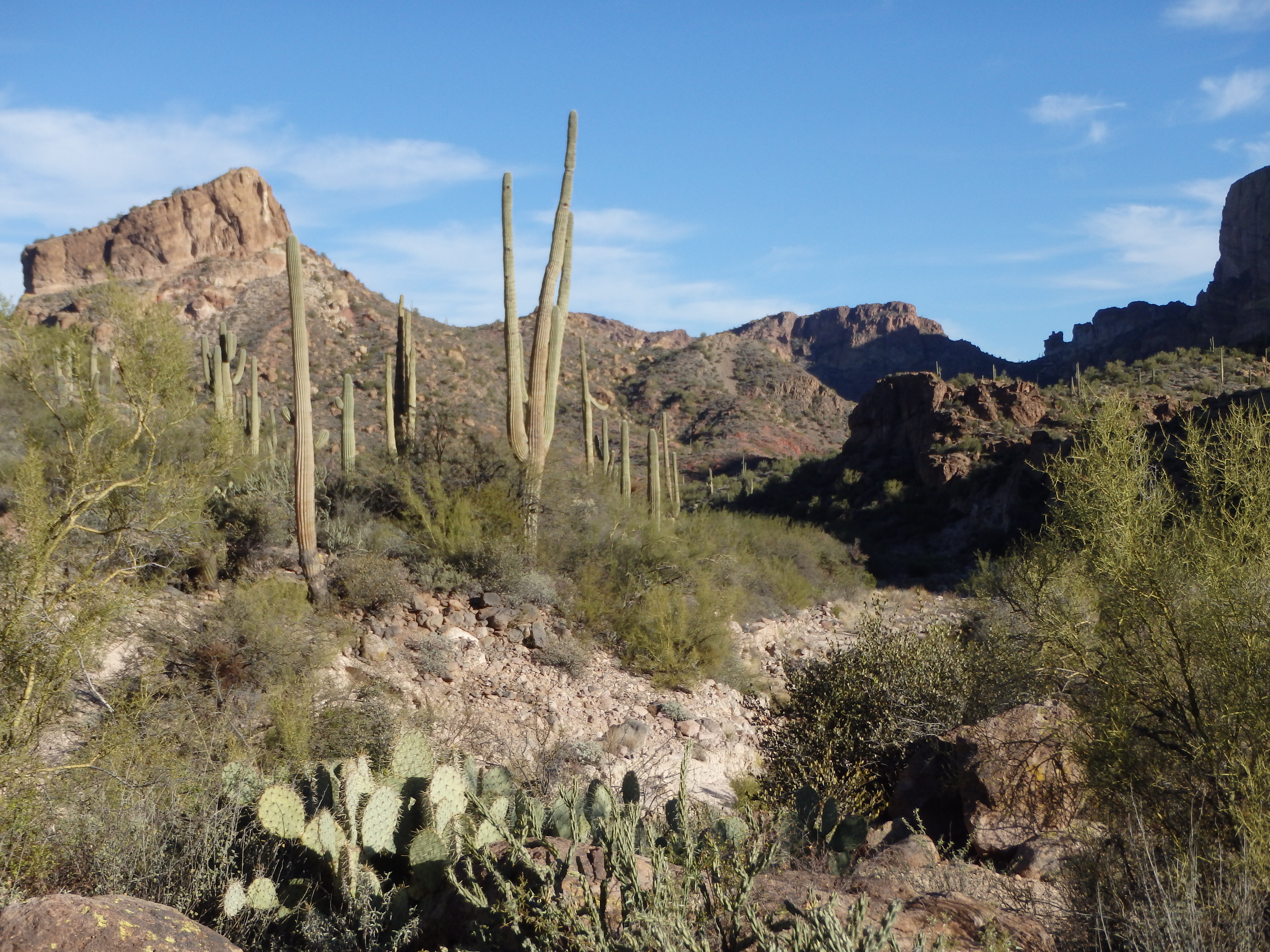
I had expected to be alone for the majority of the day, and was surprised to find about 20 cars in the dirt lot when I pulled up. It seems this was a popular backpacking route given the number of reliable springs, and many groups had headed in the day before on New Year’s day. I set out with just enough light to not need a headlamp, taking a left onto the Second Water Trail. The trail enters Garden Valley, a broad basin where I encountered the first set of backpackers with a morning fire. From here I had a look at the first summit of the day, Hackberry Mesa.

As I closed in on the Mesa, I left the trail earlier than I had planned, as it didn’t seem all that difficult from below, and I wanted to get into some sunlight to warm up. I headed upslope and followed the rim of the mesa to the highpoint, and took my first break, about 1:15 from the start. The views of the backside of The Flatiron were impressive from this angle, and you could almost see to downtown Phoenix.
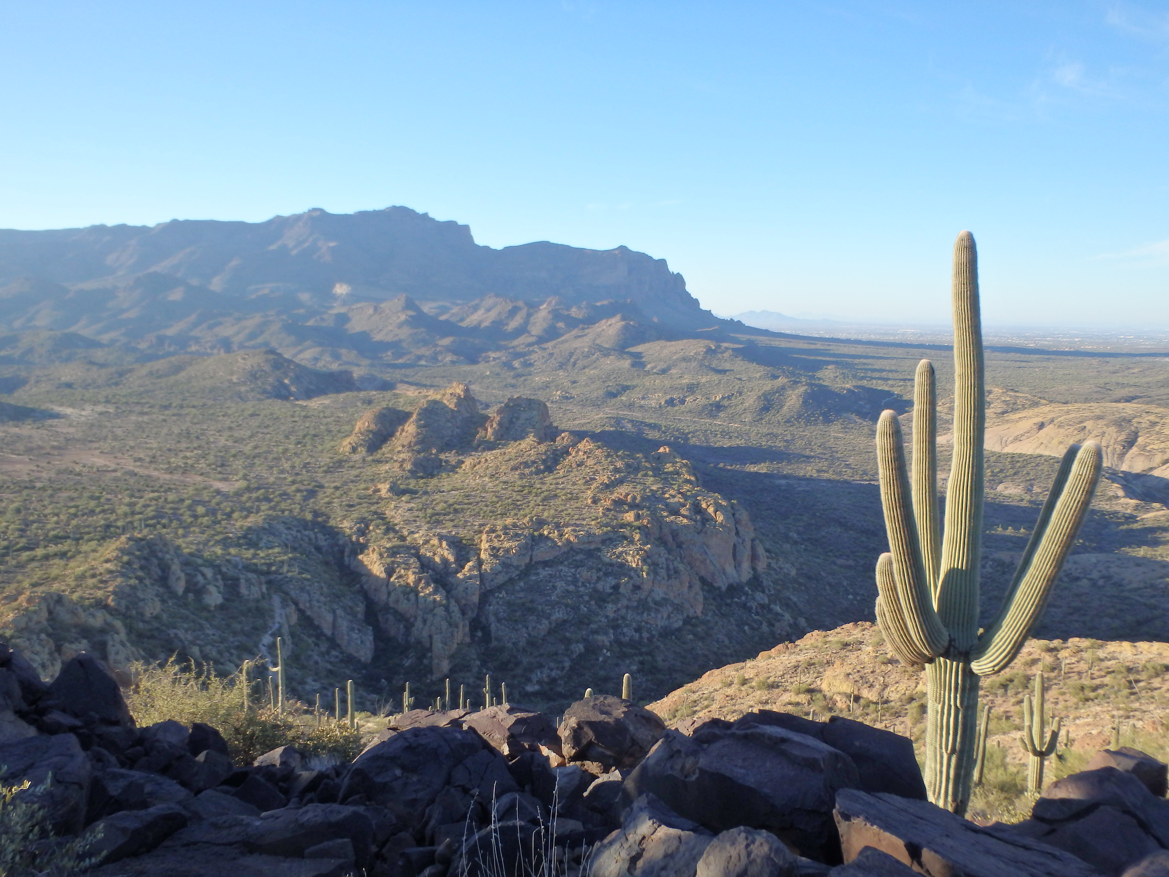
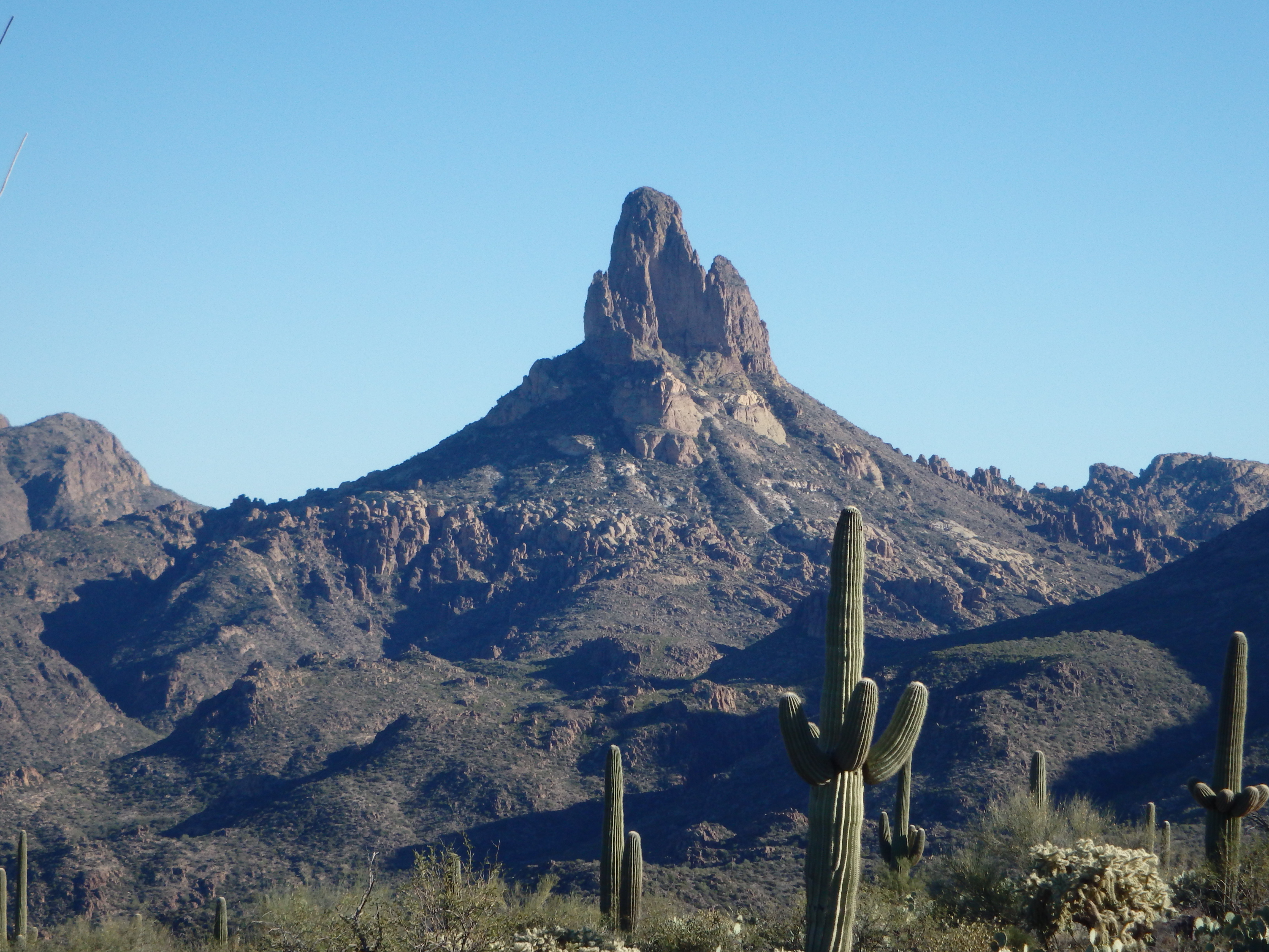
I also had my first look at the Battleship, although it was nearly completely eclipsed by Geronimo Head and Malapais Mountain.
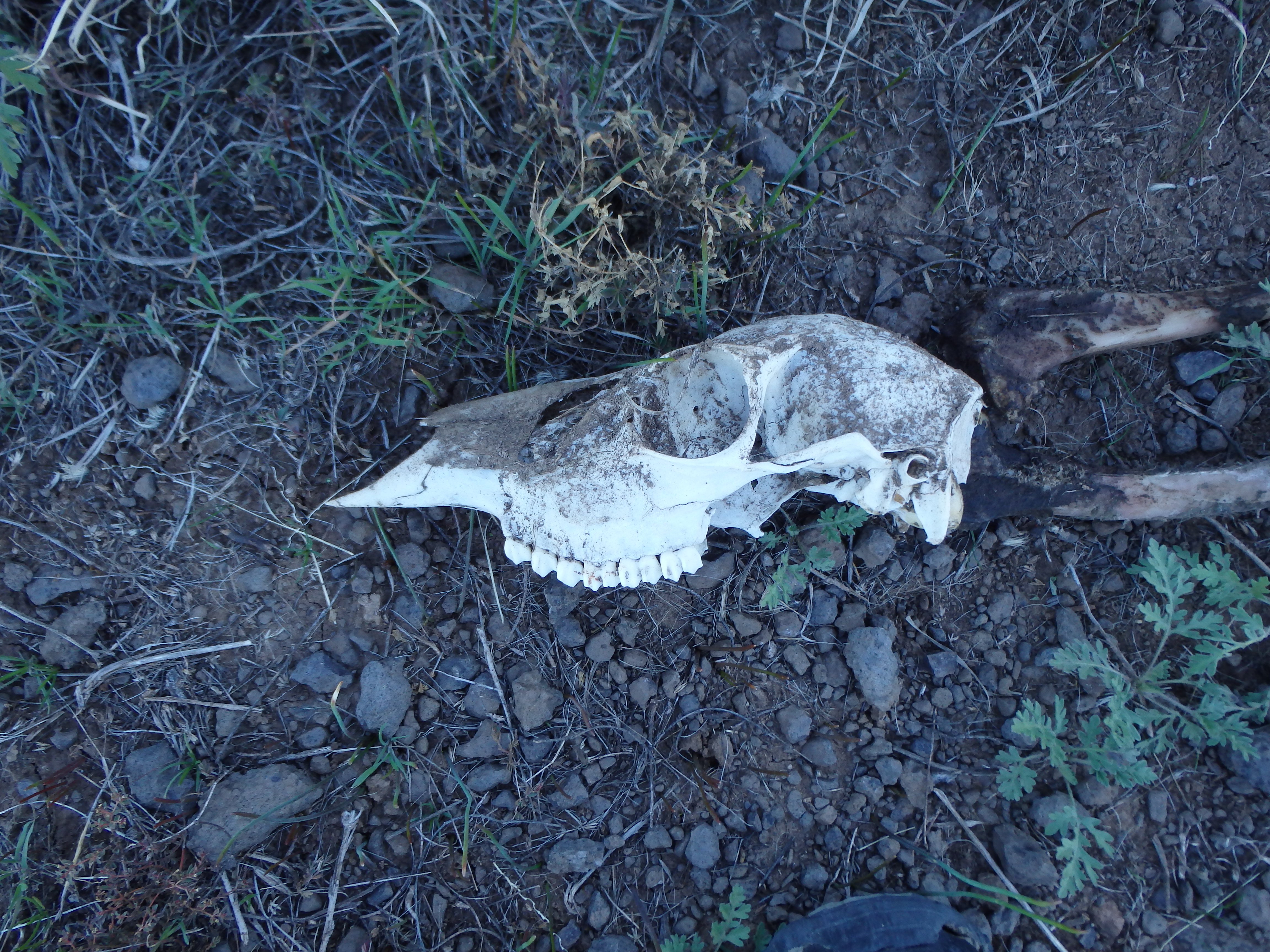
After leaving the mesa, I had planned to cut cross country at an angle and meet up with the trail as it descended into Second Water Canyon. However the NE facing slopes were quite brushy, and I was forced back along the mesa rim to meet the trail not far from where I had left it earlier. On the descent I fell on some loose talus, landing completely on my left shin, which left a huge bruise the next day. Dropping into Second Water Canyon, the walls started to close in with dry falls and several active springs below. Just before hitting the upper spring, I nearly stepped on a very fresh, bizarre looking animal on the trail. I hadn’t seen anything like it before, and later learned it was a Coati, an Arizona native related to the raccoon.
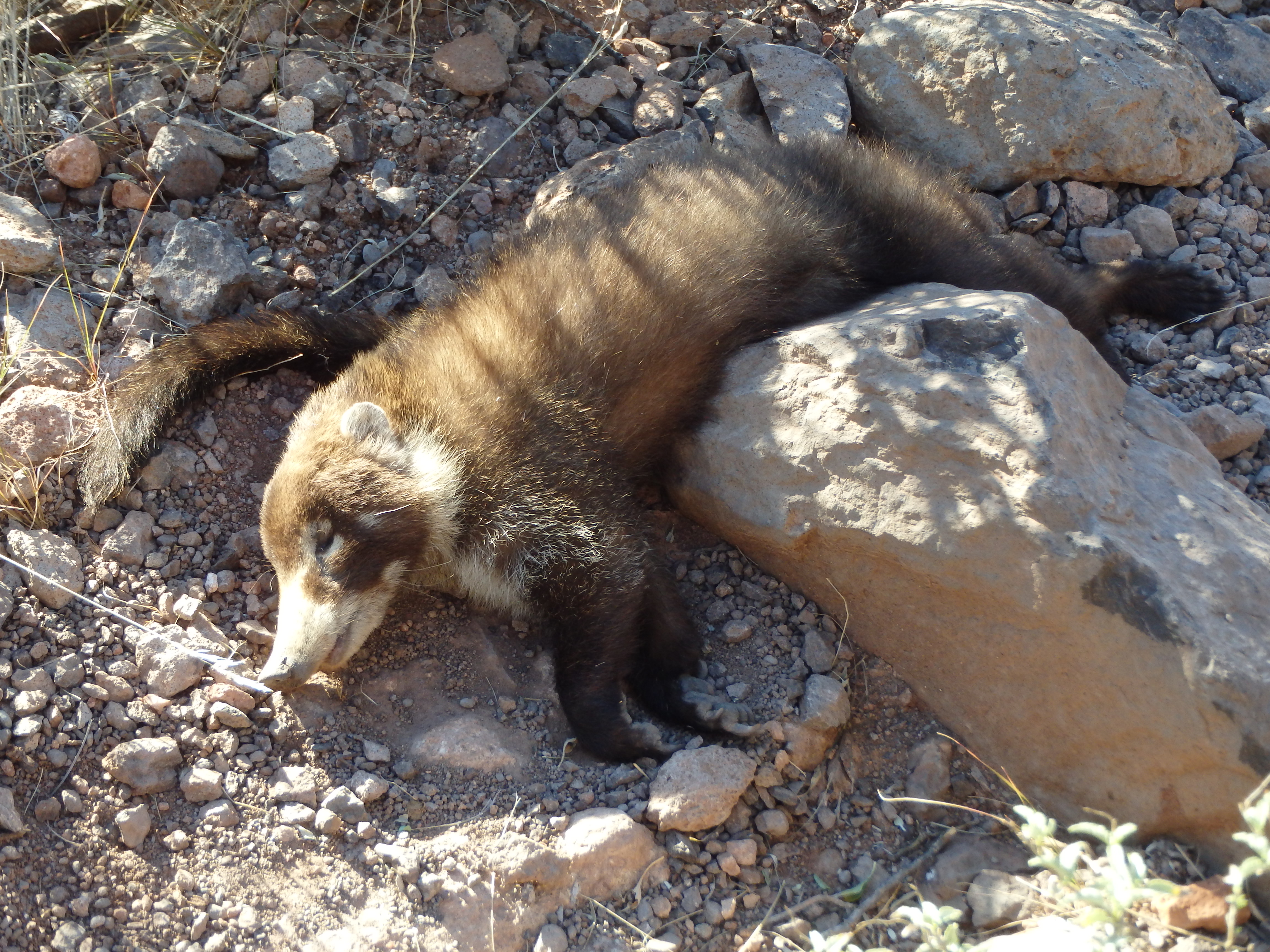
It seemed odd that it had died directly on the trail near water, and I was surprised the vultures hadn’t found it yet. I continued along the trail descending deeper into the canyon, passing a few more campers set up near some of the springs with more consistent flow.

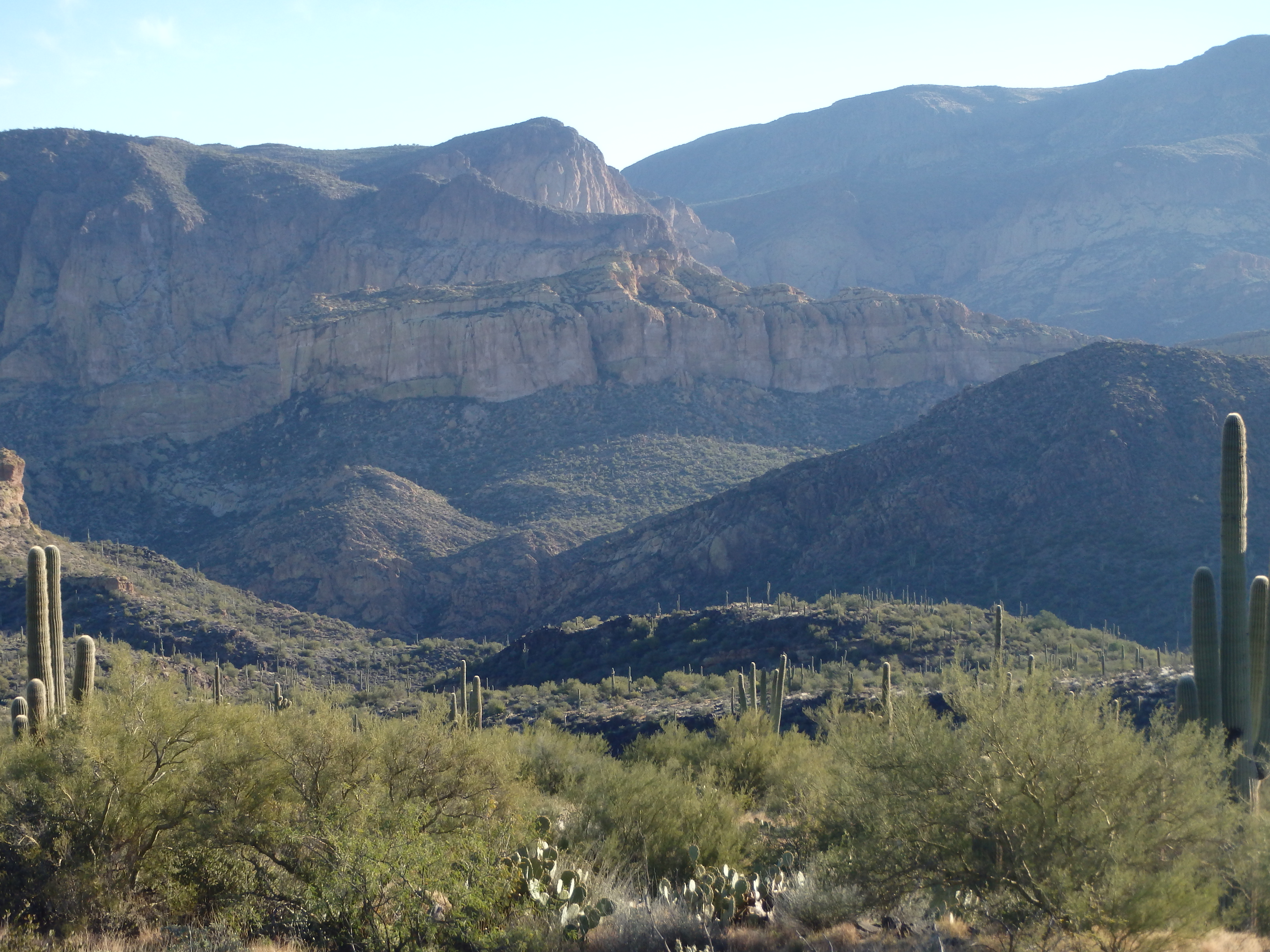
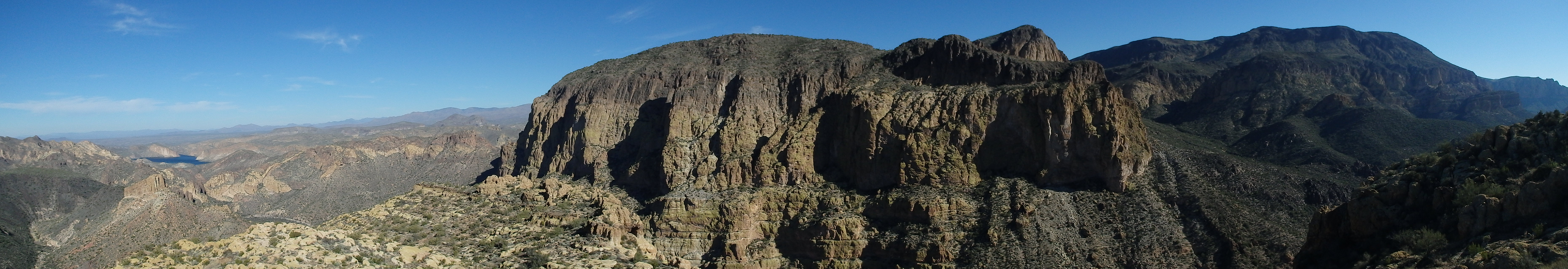
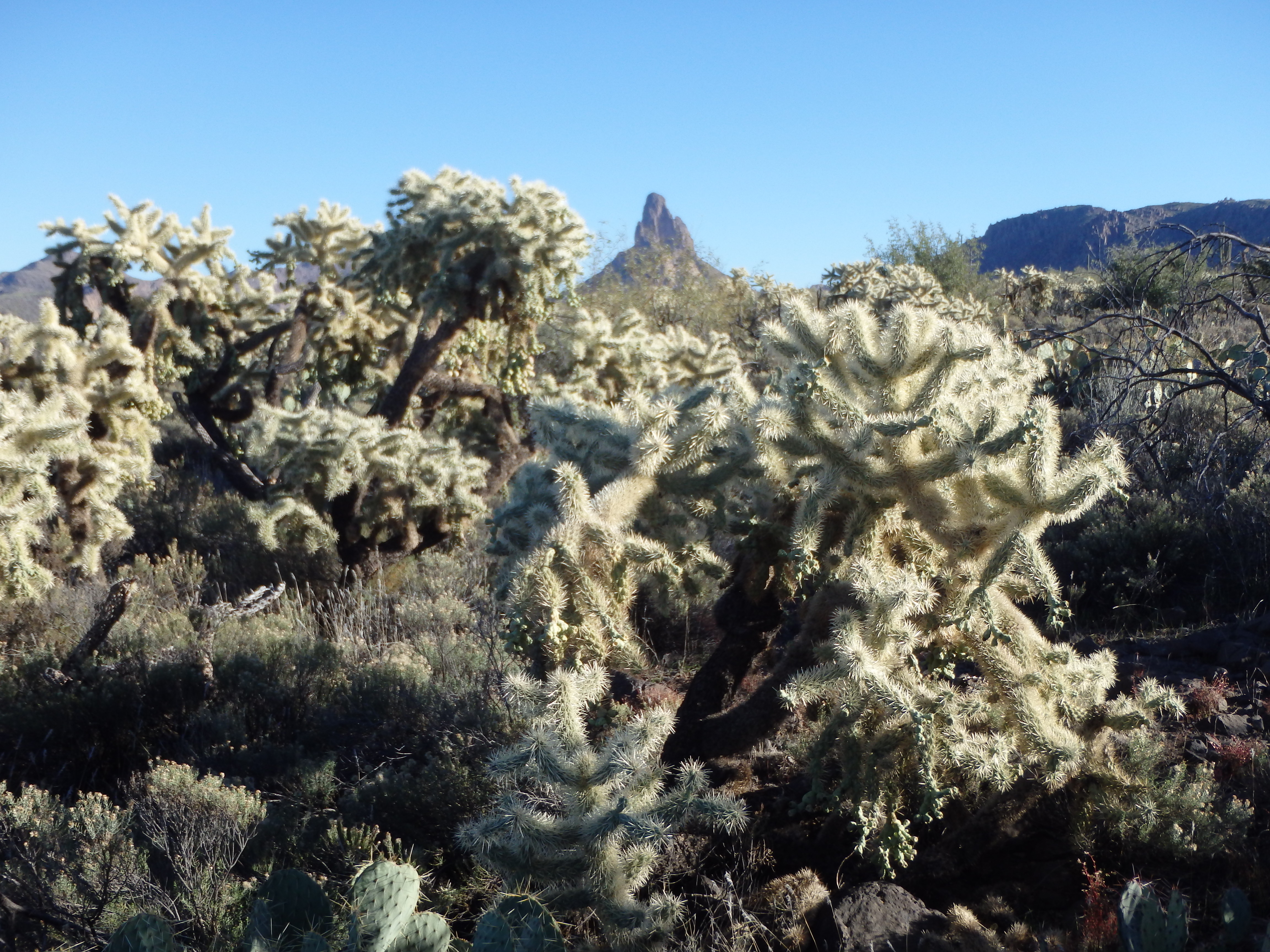
Finally, Second Water Canyon spilled into the much larger Boulder Canyon, and I entered a broad wash with Battleship Mountain looming high above. To get on top of the rocky ridgeline, one must head upstream in Boulder Canyon and climb the start of the southern mesa of Battleship at point 2551′. I followed the trail, boulder hopping in the wide wash, looking for a route up.
After about a half mile, I found a pretty distinct ridge that heads up towards the start of the cliffs, and I was pleased to find a use trail right from the start. The slope wasn’t very brushy, and as I looked around I saw cairns placed seemingly at random, suggesting that you could make it up any number of ways.

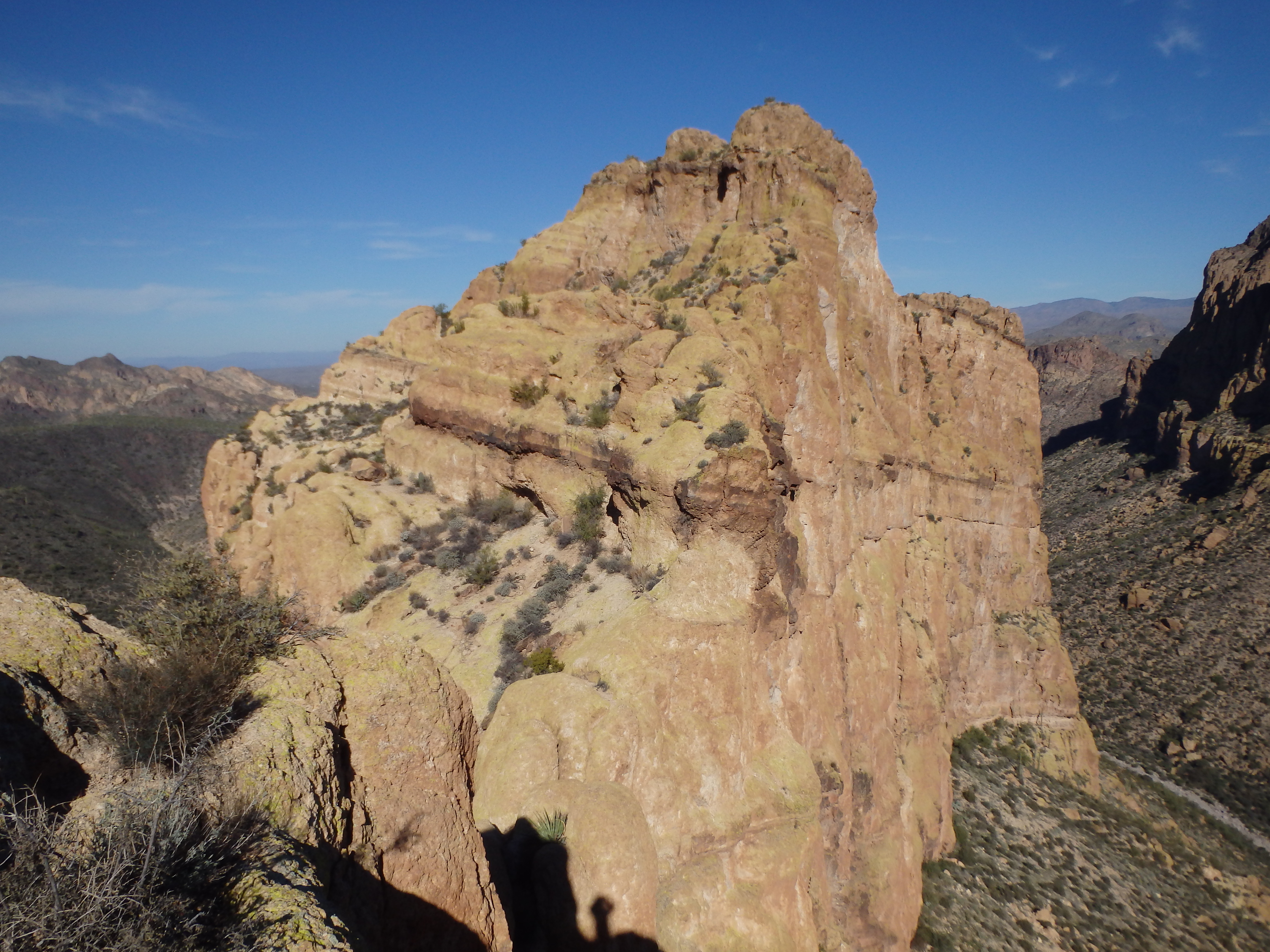
As I neared the cliffs of the southern mesa, the use trail became more distinct as I traversed west of some cliffs to a large boulder near a prominent Palo Verde tree. It was here that the class III began, as I hopped on top of the boulder and started climbing the volcanic rock, covered in a lime green moss. About 20-30′ of class III brought me on top of the southern mesa, which I followed along to the north.
As I grew closer to the northern mesa and ridgeline, I was surprised by how difficult and fractured it looked from a distance.

An even bigger surprise came when I saw about 10 people descending from the summit towards me. It seems a HikeAZ group had left the trailhead at about the same time as me, but had passed me when I turned off towards Hackberry Mesa. They assured me it wasn’t as bad as it looked and I crossed the narrow gap between the southern mesa and the start of the summit ridgeline. After crossing a narrow gap, the scrambling started early as I climbed on one of a series of rock ribs, hopping from one to the next to gain elevation. I aimed for a prominent Saguaro, the only large one along the ridgeline, which sat in a gully with a good use trail. I followed the use trail for a few minutes and came to a drop off and narrow crossing below.
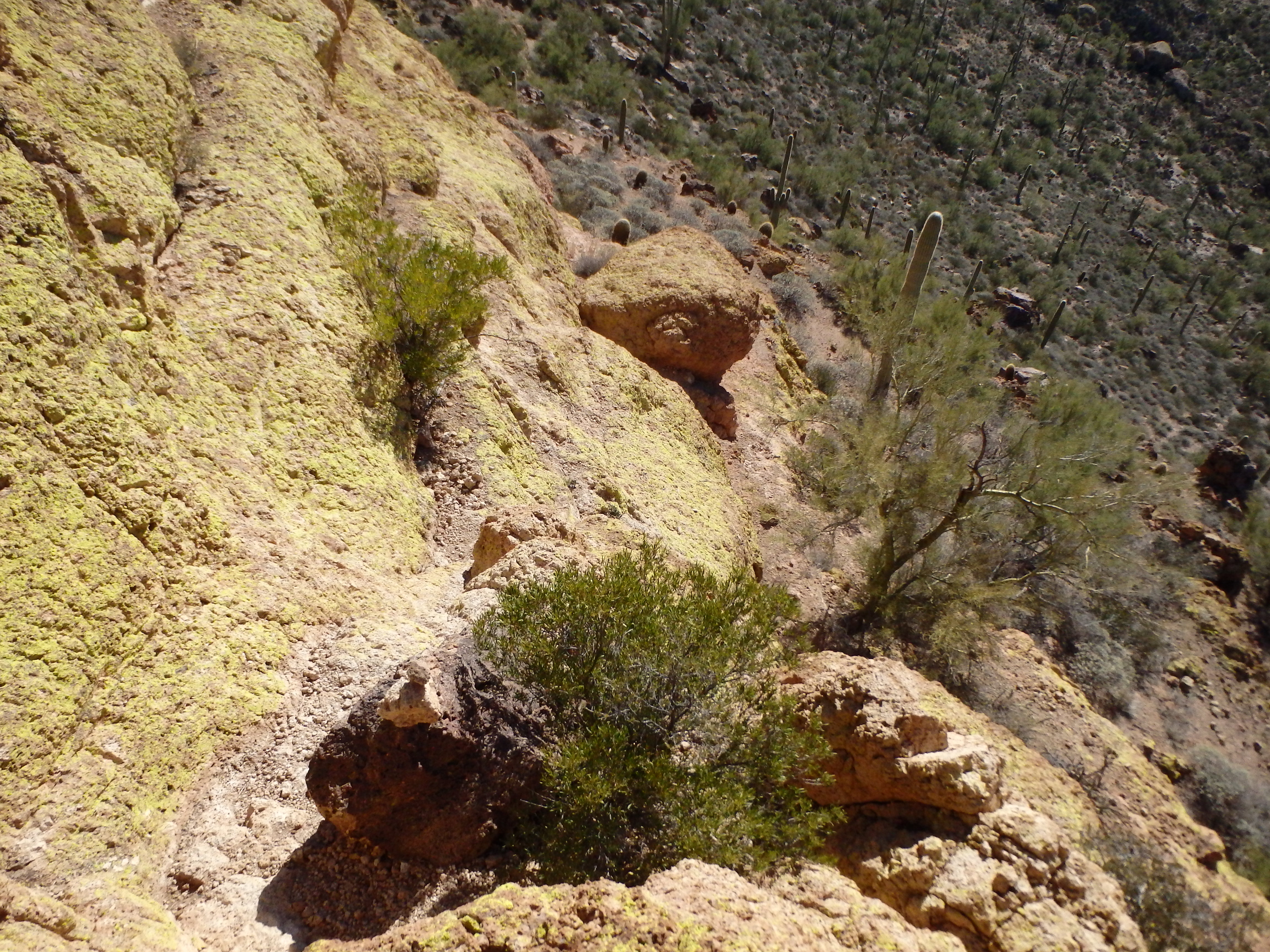
It seems I had missed a turn off, a short descent to the left which followed some shallow ledges to the narrow crossing. Across the narrow section, I quickly got off trail again, thinking I needed to traverse far left around some large blocks. In reality, there’s a steep class III crack in the rock face that must be climbed, about 12′, the crux of the day.

From there, the route traverses and drops about 50′ to the left to avoid some cliffs on the southern aspect of the summit. The traverse was loose, and is known affectionately as “ball bearing slope,” although it is not exposed and merely tedious as opposed to dangerous.
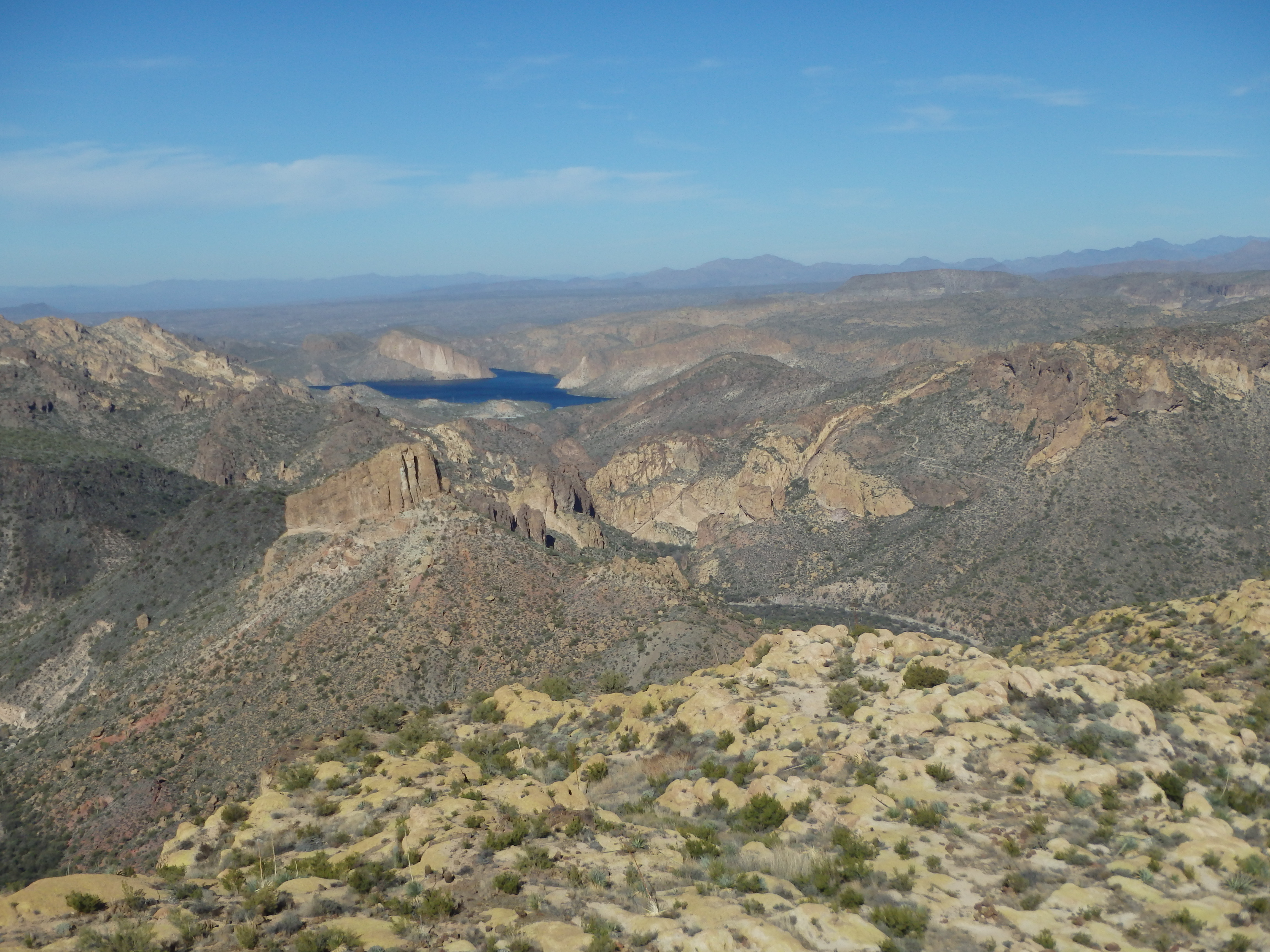
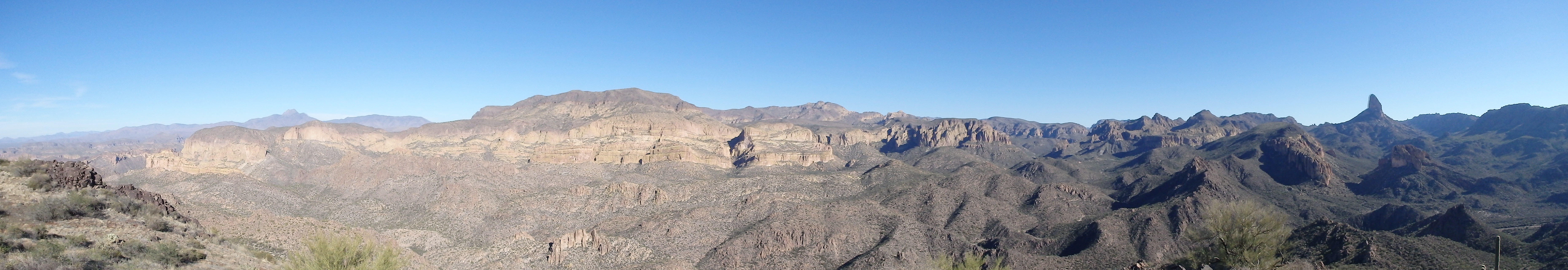
Past the loose slope, the trail climbs a steep gully to obtain the northern mesa, with the summit rocks another 50′ above. I believe there is a trail that one can take from the summit from this point if you swing around farther, but climbing the rocks directly is no harder than the scrambling from earlier in the day, and I soon topped out on the windy summit. The views were impressive, with hazy but prominent views of Weavers Needle to the south, Canyon Lake to the north, and La Barge Canyon directly to the East.
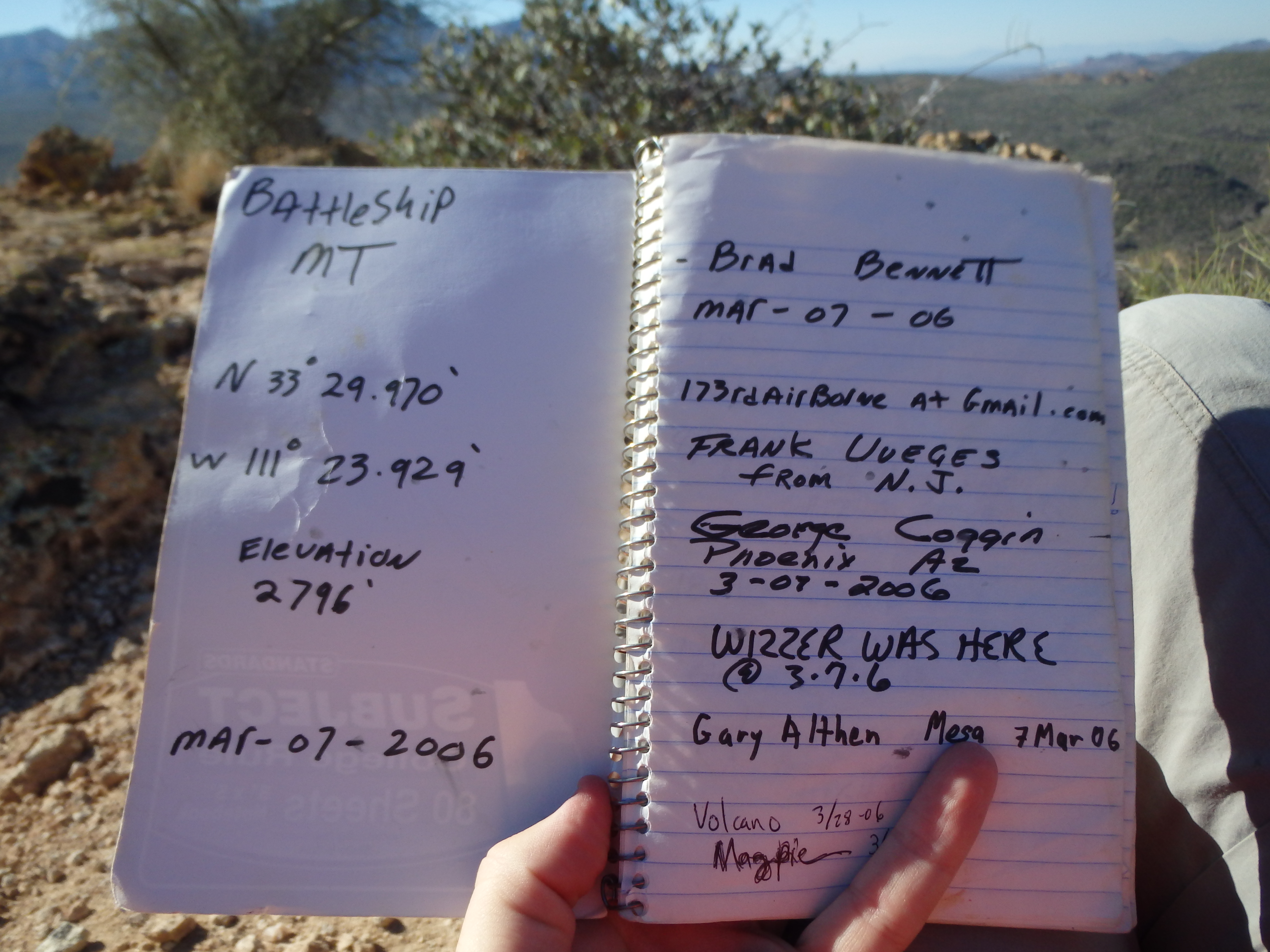
I rested for some time at the summit, looking through the summit register dating back to 2006, placed by Brad Bennett, a fellow Wilderness Medical Society member whom I had met some years ago.
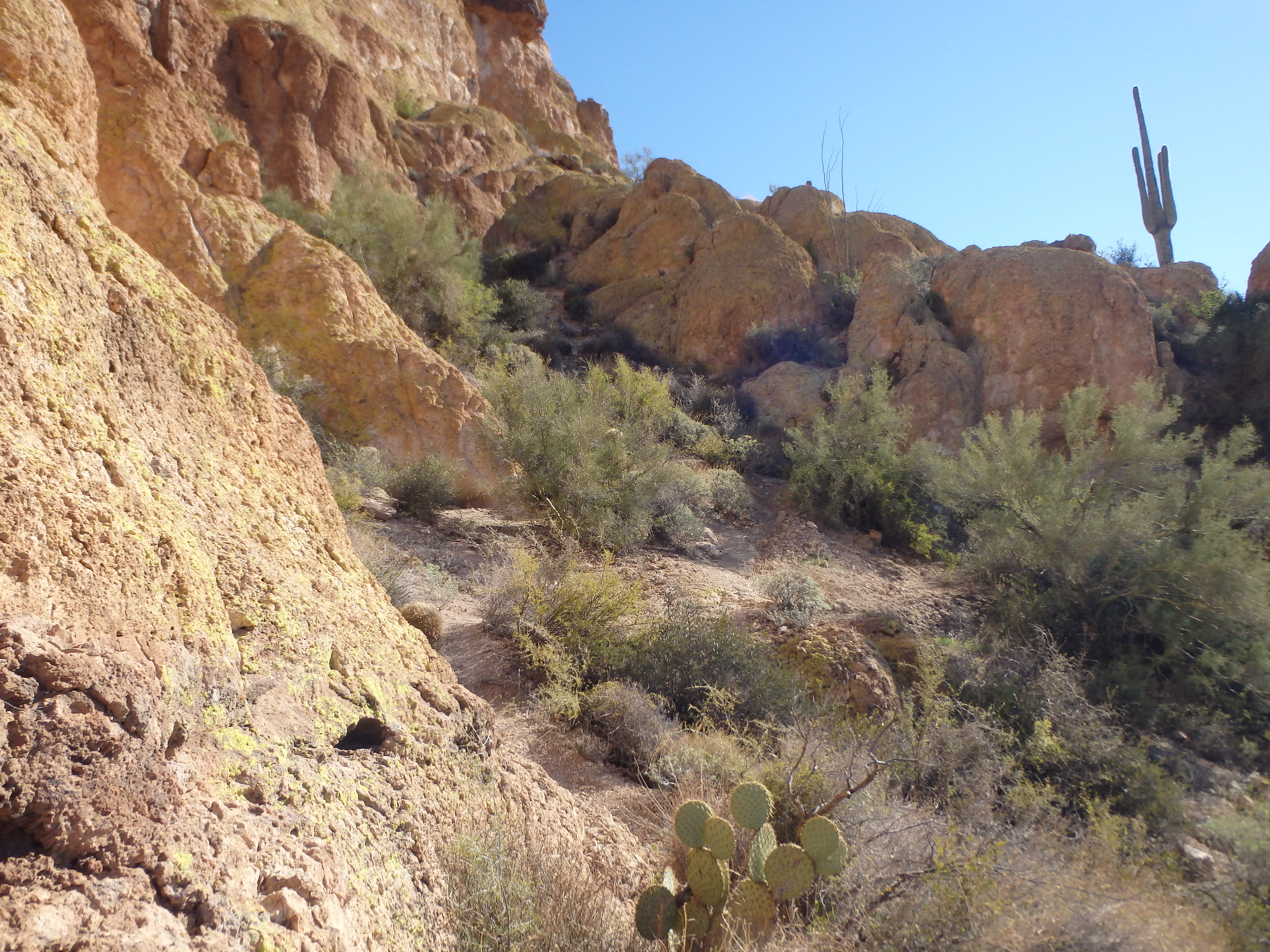
Knowing I still had a full day ahead, I left the summit after 10-15 minutes. It took 20 minutes to return to the narrow crossing with the southern mesa knowing the route on the return, and I dropped down to Boulder Canyon thereafter. My plan from here was to follow Boulder Canyon for several miles to its’ intersection with the Black Mesa/ First Water Canyon Trail. As I headed south up Boulder Canyon, I consistently would lose the trail in the wash. While this wasn’t a big deal in terms of route finding, it made the going slower than expected. Additionally, when the trail would leave the wash along the banks, it was quite overgrown with cat claw, pulling at me with every step, becoming quite exhausting. After a good hour of this, I started to look for an alternative way to head towards Yellow Peak, my next objective. From the map, it looked like I could leave Boulder Canyon and head up any number of ridges towards the peak directly. As I rounded a bend, I saw a nice, relatively brush free ridge that headed up and decided to go for it. The going was easier than the wash, and I soon was following a rock ridge towards the summit, guarded by namesake yellow cliffs.

The ridgeline bypassed the cliffs to the east, and I quickly found myself on the summit. The views from here were probably even more impressive, with a smack-you-in-the-face look at Weavers Needle, and a wide view of the enormous surrounding basin.
There was a summit register at this summit as well, showing only 1 or 2 people per year since 2012. Surprisingly, someone had been up there earlier that same day! The sun was already getting lower, and I eyed my last stop, the highpoint of Black Mesa. It looked like it wouldn’t be far off of the trail, but it was difficult to say how much cacti I would need to fight through to obtain the summit. I dropped off the ridge, again skirting the yellow cliffs, and hit the Black Mesa trail at about 2650′. This ridge is probably the best place to climb Yellow Peak if it was the sole objective for the day. I hiked up the trail for about a half mile, and started up slope when I figured I was below the highpoint. Initially the going with easy enough, with big prickly pear that could be easily avoided. But the closer I came to the highpoint, the more dense the cacti became. Soon I was surrounded by jumping Cholla, the most evil of cacti, some taller then me.
I slowly weaved my way around them and finally made it to the summit, looking down on Parker Pass. The views of Weaver’s Needle were good here, but not quite as impressive as Yellow Peak. I briefly considered dropping off the mesa into First Water Canyon, but the terrain below looked like it had many washes, and at 15 miles in, I just wanted a simple trail to get me back to the car. Thus, I retreated the way I came, slowly through the cholla, hitting the Black Mesa Trail shortly after 4 PM.
After a short water break, I tore off down the trail to close the loop with the Second Water Canyon Trail, making it to the car at 5:15 just before the sun set over the Flatiron. From there, I drove directly to In’N’Out Burger to undo all the calories I had just burned.
Hi Christopher! I’m Ricky from the YouTube channel Explore With Us. I came across your photo of Battleship Mountain, Arizona posted here on January 13th, 2016, and was hoping to get your permission to use it in a video. We’re making a video about a young man named Khayman Welch who went missing in that area last summer, and we’re trying to get the word out to help find him. We will give you full credit for using your photo in the video. Thank you so much, and hope to hear from you soon!
Sure not a problem! Feel free to use any photos you need.
Great! Thank you so much! It will be up on Explore With Us in about one week!