
Capitol Butte 6255′
Total Time: 2:45
Round Trip Mileage: 3.9 miles
Elevation Gain: 2400′
Crux: Class 3
Trailhead; Lizard Head- pit toilets, trash (Red Rocks Pass required)


The trail that accesses the ridgeline shares the same starting point for the very popular Devil’s Bridge hike, and the parking lot was nearly full when I arrived at 8AM. Two trails leave from the Western end of the lot, the Devil’s Bridge Trail and the Lizard’s Head Trail, which skirts the ridgeline en route to Chimney Rock. Since that trail initially heads away from Capitol Butte, I decided to head cross country with the assumption that I would eventually hit the trail. For the most part, cross country in the Sedona area is pretty easy, with Junipers spacing out the cacti and denser brush. I made my way around various use trails, generally aiming for the ridgeline, when I came to the top of a small rise to find I was on the wrong side of a shallow drainage. I gave up hope of intersecting the trail I should have taken from the start, and looked for a route that would cross the drainage to take me to the proper ridge. This was the only significant brush I encountered for the day, as I fought my way through manzanita and young scrub oak, growing a bit thicker on the shady northern slopes. I made my way up to the rock formations below the ridgeline and found the use trail I had been looking for, a well defined path running along the base of the cliffs.

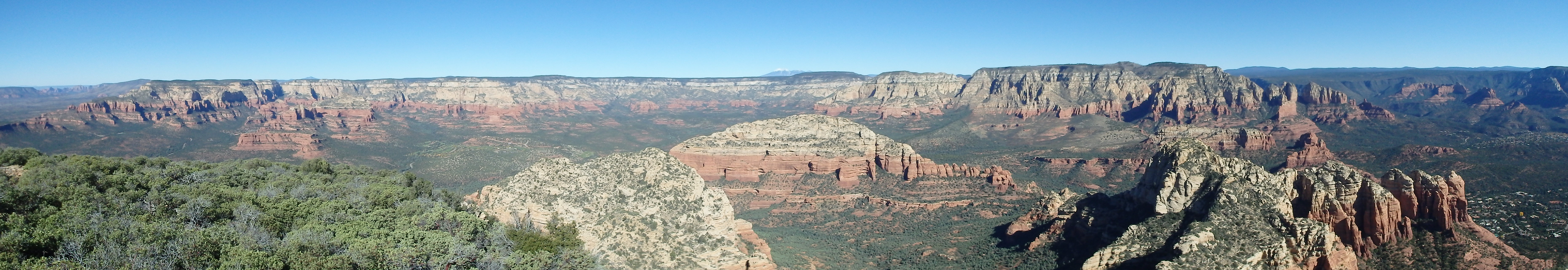
With the brush behind me, the rest of the climb became downright pleasant as I followed the easy to follow trail along the base of the Sandstone cliffs, up some easy class III and onto the ridgeline proper. I took a short break here as the views opened up to the various buttes and summits to the west.

The remainder of the route was hidden from view as I started climbing again, trying to keep true to the main ridgeline when possible, enjoying the bits of class II and III along the way. Just before the ridge hooks north towards the summit, there is an impressive false summit of sandstone, which I scrambled up to survey the remaining route. While the rest of the ridge was in view, it was difficult to see the actual route, with blocks of Coconino Sandstone steeply running up towards the summit.

I dropped off this intermediate highpoint to avoid some drop offs and found myself at a shallow saddle with another 600′ to go. Up until this point, the climb had been very enjoyable, but was still mostly class I with class II and III mixed in here and there. That dramatically changed at the saddle as the ridgeline steepend considerably and I began to face pitch after pitch of class III.

The way was very well cairned, and most of the time, the easiest route is obvious. The two toughest pitches were a short 8′ crack the was angled back downslope, and a steep, 12′ dry waterfall.

The waterfall can actually be bypassed by a crack a bit farther to the right, but I didn’t find this until the climb down.

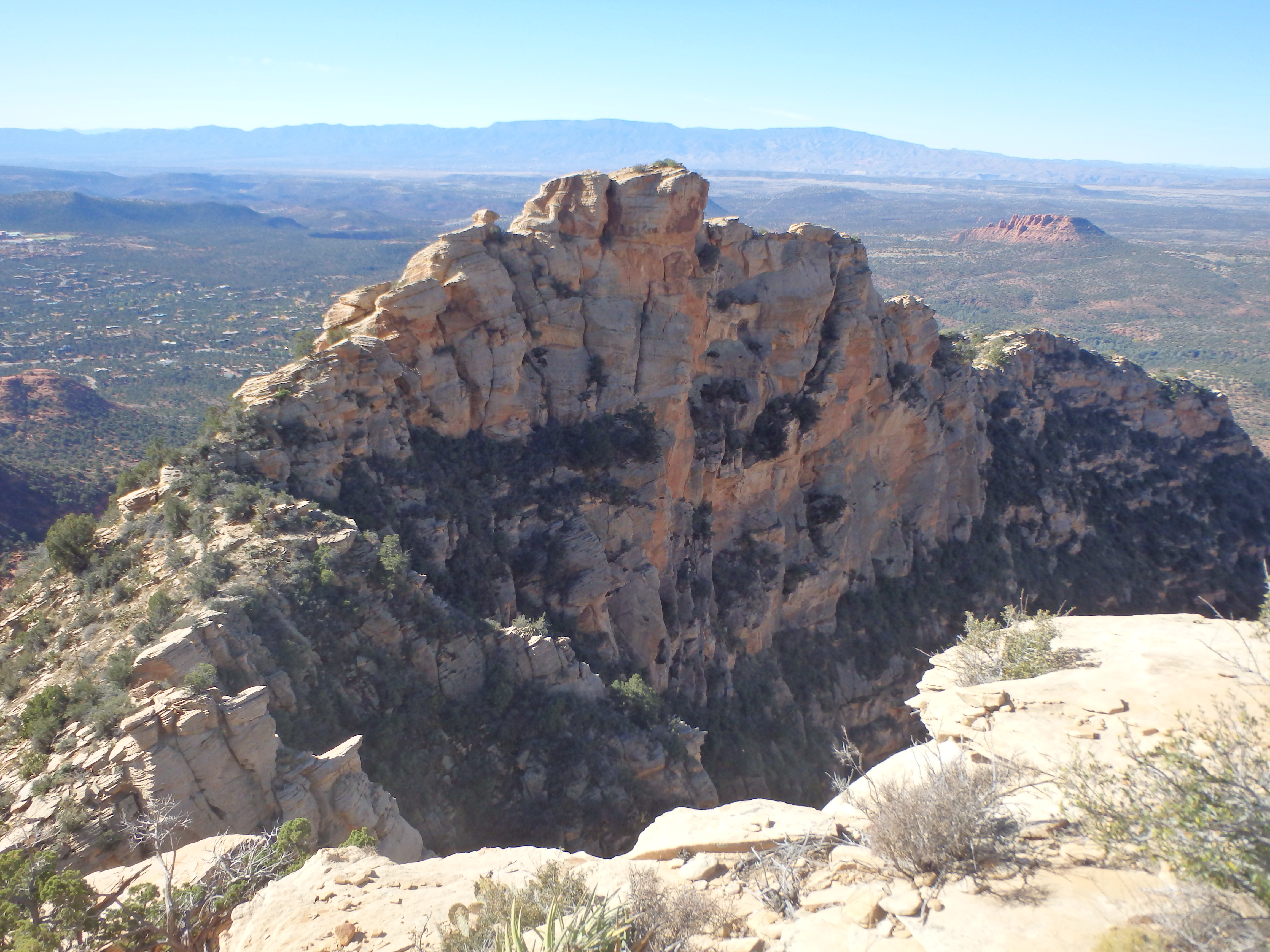
After the dry falls, the route climbs a class II ramp that put me on top of the steepest section of the ridge, with another 100′ of class I-II trail to bring me to the summit blocks, with the eastern blocks being slightly higher. While the majority of summits in Sedona are flat, Capitol Butte is slightly rounded on top and separated from the main rim by over 1000′, giving true 360 views all the way to snow capped Humphreys Peak near Flagstaff.

Just west of the summit, I also found some rocks arranged in a circle, similar to the circlestone ruins in the Superstition Mountains, although I don’t know if they’re actually Native American ruins.

I enjoyed the summit for quite some time before finally descending the way I came. The descent was overall uneventful as the trail was easy to follow and I was able to find a bypass around the dry waterfall. I planned to keep to the trail as long as I could to find where it meets the Lizard Head Trail lower down.
I dropped off the ridge and skirted the sandstone cliffs as before, following the trail steeply down the ridge. When it was about 200′ above the valley floor, I could see the established trail below, with the use trail I was following paralleling it with no hurry to meet up. I decided that it was silly to continue on this meandering path and cut cross country to meet up with the main Lizard Head Trail. From there, it was easy trail to make my way back to the trailhead. From there, I headed west for a short climb of Mescal Mountain…..
Just did the Lizard head route (april 18 2026).
Fabulous climb, the dry waterfall/slab crossing was a bit spicy on return, but sticky rubber approach shoes helped. Did not encounter the slanting crack, must have bypassed it somehow. On return missed the drop off trail to the north of Lizard ridge, so had to do a bit of backtracking, looks lite quite a few people did it too.