
Mount Wilson 5445′
Total Time: ~3:30
Distance: 4.8 miles
Elevation Gain: 3000′
Crux: Class 2
Trailhead: End of Black Joe Mine Road, 4WD, no services


Mount Wilson is a 5,000′ summit in northwestern Arizona immediately south of Lake Meade. Providing some of the best views of the southern shores, I was interested in it for its’ 2,000’+ of prominence, and it would be the first peak for day 2 of my three day romp peakbagging off of US 93. After climbing Mount Tipton and Peacock Peak the day prior, I drove north to nearly the AZ-NV state line, pulling onto Black Joe Mine Road a few miles before the border. I had chosen the western approach as it required a bit less dirt road driving and a little less elevation gain and mileage. However as I started up the road in darkness, I quickly found why this approach is a bit less popular- the road was in pretty bad shape. Pretty early on my Subaru Forester struggled up a steep and rutted section, and I nearly threw in the towel and turned around before deciding to floor it up the loose rocks, pushing through the worst section of road early on. It was only about 3 miles to the unofficial trailhead, but I white knuckled the steering wheel in darkness until I had reached the turn off. I slept in the back of the car overnight and woke up with the sunrise, wanting to get a jump on the heat on one of the shorter summits of the weekend. I left my car and crossed a shallow wash to get on a north running ridgeline which paralleled the main ridges of Mount Wilson to the west.


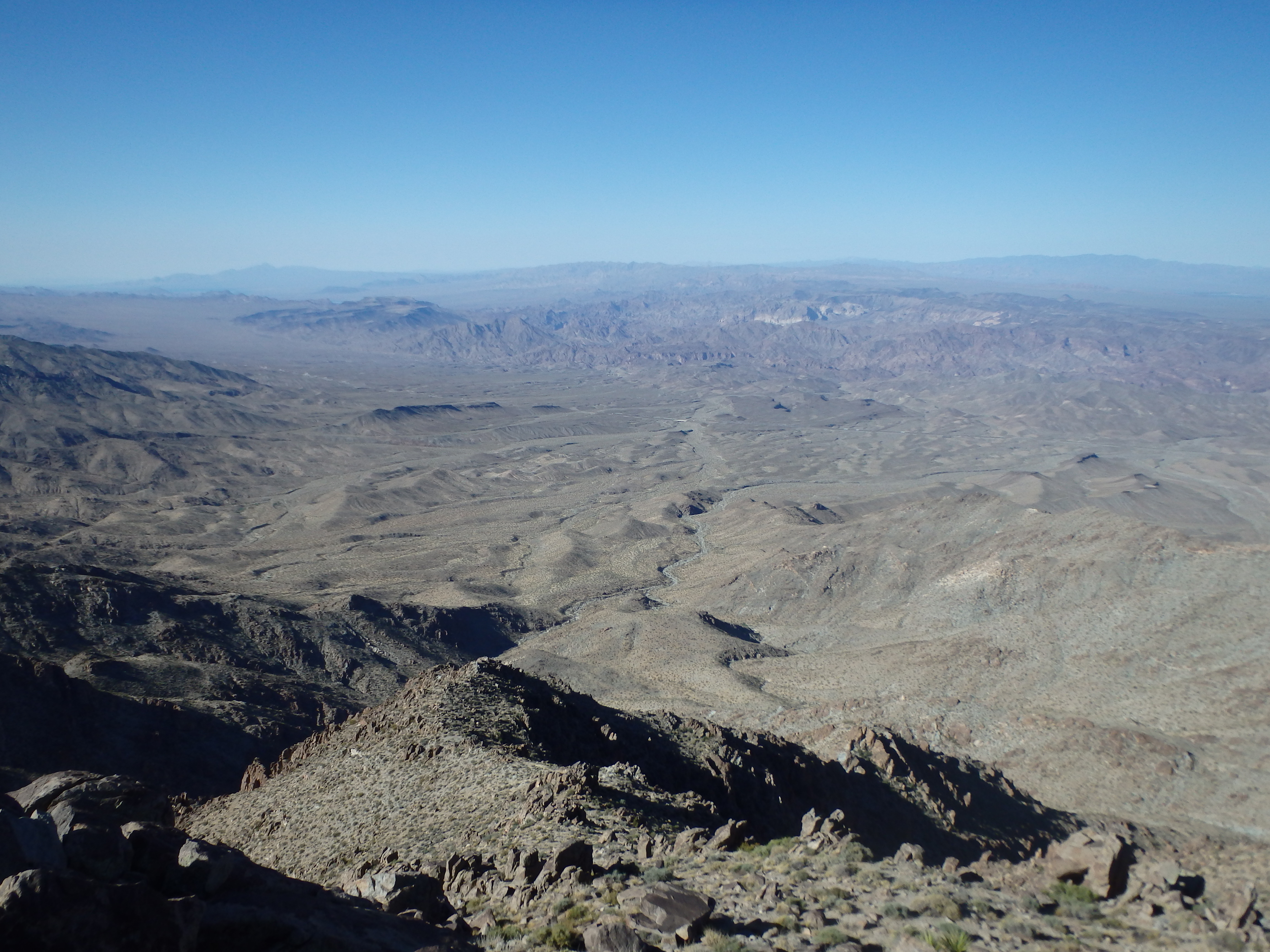
This seemed to have a faint use trail, although compared to Tipton, there was little brush to contend with at this lower altitude. A nice reminder of why I love hiking in the Mojave so much… It took me less than 30 minutes to reach the first of many false summits and the main western ridgeline of Mount Wilson. This gave me the first glimpse of Lake Meade and downtown Las Vegas in the distance, with Red Rocks and Mount Charleston looking surprisingly close.

I followed the ridgeline east, now heading directly for the summit. I lost a little bit of elevation heading to the next false summit only to find an even larger gap on the other side, probably about 400′. Another likely reason this route was a bit less popular. I had to traverse under a few loose rock fins to the south before dropping into the deep saddle and starting my way up again, this time skirting the rock fins and gendarmes to the north and scrambling along them when possible.


This was probably the steepest section of the hike, and when I topped out on the next flat section of ridge, I scared a lone desert big horn sheep who tore down the slope before I could grab a picture. The summit, which had been largely out of sight for most of the day, was now directly above me and surprisingly close, probably only another 30 minutes more of hiking.

A use trail became more defined on this upper section of trail, probably intersecting some other route I was unaware of for the final summit push. There were a couple options to gain the final summit rocks and I opted for an exposed class 3 variation to get me to the summit rocks, taking under 2 hours from the car. The views of Lake Meade and across to downtown Las Vegas were truly outstanding, and it was probably my favorite summit view of the trip. Being so close to Vegas I was surprised at how few entries there were in the summit register seeing only about a dozen parties a year.


I had breakfast on the summit before starting back down the way I came, trying to plunge step down the scree with a long drive to Grand Wash Cliffs/ Duncan BM planned for the afternoon. There was no sign of big horn sheep on the descent, although I nearly down climbed into an active beehive in a small cave, and only spotted the stream of bees coming out of the rock when I was just a few feet above them. Luckily I made it past without incident and made it to my car in under 4 hours, a time I was pretty pleased with given the 3000′ of ascent for the peak. I slowly worked back to the US 93 on Black Joe Mine Rd, the rougher spots a bit easier with gravity on my side. I reached the pavement by 10:30, but it would be several hours before I reached the starting point of Grand Wash Cliffs, quite a ways away near Grand Canyon West.
